
Standardizing Marine Biodiversity Data
For scientific organisations such as the Institute of Marine Sciences (ICM), aligning with international standards is not just a technical matter, but a strategic necessity to ensure that their research has a real-world impact.
Standards allow data to move beyond static, isolated files and become “living data”: information that can be integrated into global networks and used by the international scientific community. The main frameworks used in this project are:
- Darwin Core (DwC): A standard that acts as a “universal language” for sharing biodiversity information.
- GBIF (Global Biodiversity Information Facility): The world’s largest biodiversity data network, which relies on standardised formats to bring together information from thousands of institutions.
- EMODnet and OBIS: Dedicated marine data networks that enable the interoperability of oceanographic observations at European and global scales
- Banco de Datos de la Naturaleza (EIDOS): The national standard established by Spain’s Ministry for Ecological Transition.
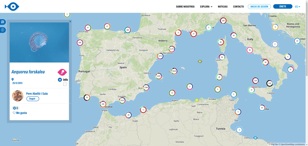
In this context, Geomatico, drawing on its experience in Environmental GIS, is collaborating with the ICM to modernise data management for the citizen science platform Observadores del Mar (OdM). To move from an outdated website to an automated “living data” system, we implemented a data model based on the Darwin Core (DwC) schema. We did it by using the event-occurrence-emof structure, which is key to integrating data into global networks such as GBIF and EMODnet/OBIS.
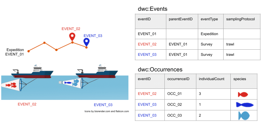
In addition, we developed an API for querying, editing and bulk data ingestion. We built several automated export tools that comply with demanding international biodiversity standards. We also completely refactored the private area of the OdM platform, allowing administrators to generate validated exports and access real-time usage statistics.
With this modernisation, the ICM is not only improving its internal data management, but also ensuring that the valuable contributions made by citizens become a high-quality scientific resource at a global scale.
To ensure scientific data quality, the Geomatico team carried out extensive data normalisation. We used the WoRMS matching tool to validate taxonomies, standardised depth and habitat dictionaries, and validated the final datasets using the official OBIS and GBIF tests.
In this presentation at the 2025 SIG Libre conference, we explain how we worked on this and other projects involving biodiversity data standards.
Do you have a project idea and want to turn it into reality? We would like to hear from you, tell us about it
The facts define us
-
Real-time public transportation visualization
https://vimeo.com/540079821/ Real-time visualization for the Barcelona metro and bus services Since 2016, Geomatico has been working with the Barcelona public transport agency (Transports Metropolitans de Barcelona, TMB) for GIS development…
-
Beyond vector tiles: Mapbox, MapLibre or DeckGL for my 3D map?
Unfortunately, there is no magic recipe for this answer, but this post will discuss in depth the pros and cons of vector tiles, Mapbox, MapLibre and DeckGL. Geomatico is a…
-
Irriter: precision irrigation visualization
http://vimeo.com/736100341 Software development for precision irrigation Irriter is an information system to help the irrigators of the Baix Ter. It is based on crop information, soil type and satellite imagery…
-
Serverless rasters in MapLibre: the COG protocol extension
After our talk at FOSS4G about vector tiles and Deck.gl, an audience member raised an interesting question: we have the tools to publish and analyze vector data directly in the…
