One kilometer from home
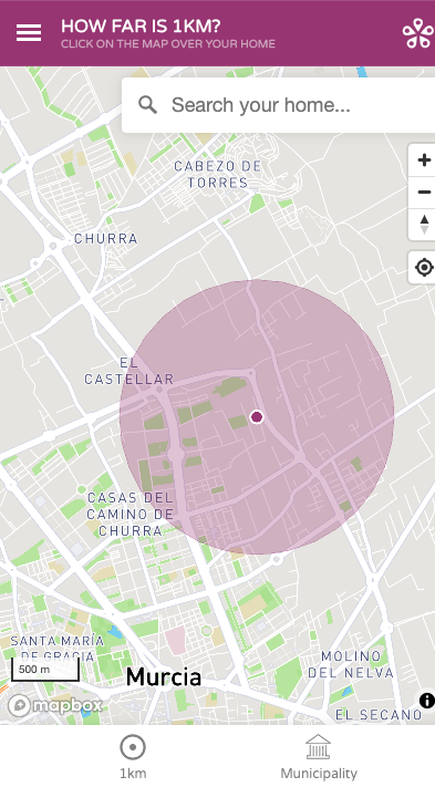
On March the 23rd, after five weeks of COVID-19 lockdown, president Sanchez announced that Spain will begin easing restrictions. In this first attempt at loosening measures across the country, children under the age of 14 will now be allowed to go outside of their homes for one hour a day, accompanied by an adult. The measure limits travel to no further than 1 kilometer from home. But just how far is 1 kilometer? To help navigate these new rules, Geomatico, a Spanish GIS company, developed a non-profit web application using donated tools from Mapbox that allows adults and children to visualize a 1 kilometer radius around their home.
In ten days, 1km.geomatico.es has become a reference for individuals and families throughout Spain looking to safely leave their house for the first time in over a month. Thanks in part to Mapbox’s support, the team has been able to deliver this mapping service for free to over 7 million users in multiple languages and municipal districts.

Want to see what 1 kilometer compliance looks like where you live? Check out the application here.
Do you have a project idea and want to turn it into reality? We would like to hear from you, tell us about it
The facts define us
-
Real-time public transportation visualization
https://vimeo.com/540079821/ Real-time visualization for the Barcelona metro and bus services Since 2016, Geomatico has been working with the Barcelona public transport agency (Transports Metropolitans de Barcelona, TMB) for GIS development…
-
Beyond vector tiles: Mapbox, MapLibre or DeckGL for my 3D map?
Unfortunately, there is no magic recipe for this answer, but this post will discuss in depth the pros and cons of vector tiles, Mapbox, MapLibre and DeckGL. Geomatico is a…
-
Irriter: precision irrigation visualization
http://vimeo.com/736100341 Software development for precision irrigation Irriter is an information system to help the irrigators of the Baix Ter. It is based on crop information, soil type and satellite imagery…
-
Serverless rasters in MapLibre: the COG protocol extension
After our talk at FOSS4G about vector tiles and Deck.gl, an audience member raised an interesting question: we have the tools to publish and analyze vector data directly in the…

